DRIVING DIRECTIONS:
![]() From
Bend, take Forest Road 46 west.
From
Bend, take Forest Road 46 west.
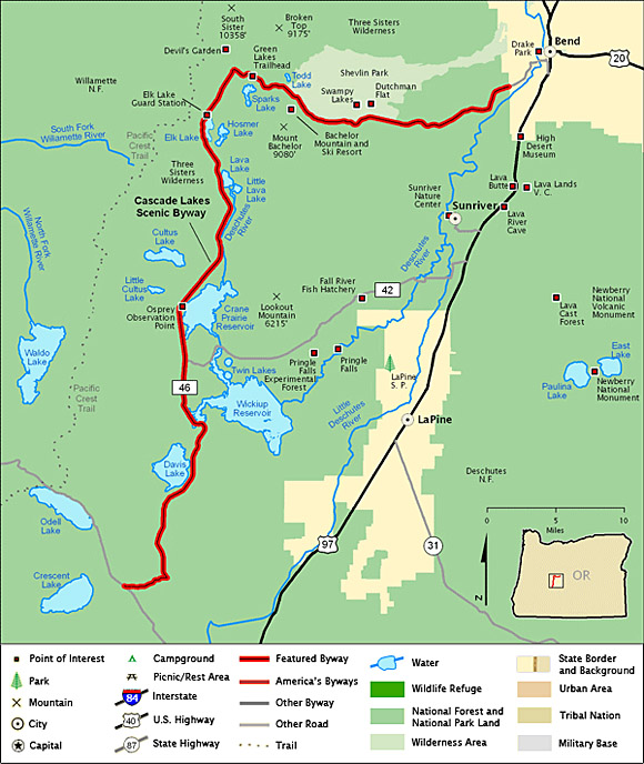
![]() The
byway travels through the Deschutes National
Forest, turning south near Devil's Lake and
continuing on past several other lakes, some of
which are Sparks Lake, the Lava Lakes, the
Cultus Lakes, Crane Prairie Reservoir, Wickiup
Reservoir, and Davis Lake.
The
byway travels through the Deschutes National
Forest, turning south near Devil's Lake and
continuing on past several other lakes, some of
which are Sparks Lake, the Lava Lakes, the
Cultus Lakes, Crane Prairie Reservoir, Wickiup
Reservoir, and Davis Lake.
![]() The
byway ends at the junction of FR 46 and SR 58
(near Crescent and Odell Lakes.)
The
byway ends at the junction of FR 46 and SR 58
(near Crescent and Odell Lakes.)
Note:
Highlighted byway routes shown on maps of
All-American Roads and National Scenic Byways
correspond to designations made by the U.S.
Secretary of Transportation. State designations
may differ.
Map & Information Courtesy of
National Scenic Byways Online.