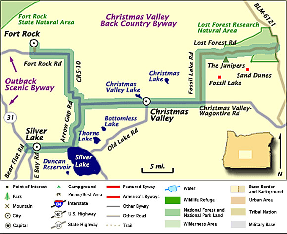
DRIVING DIRECTIONS:
![]() In
Bend get on Bend Parkway which will turn into
the Dalles California Highway/U.S. Hwy 31.
In
Bend get on Bend Parkway which will turn into
the Dalles California Highway/U.S. Hwy 31.
![]() Drive
U.S. Hwy 97 for 31.2 miles then turn left onto
Fremont Highway/U.S. Hwy 31.
Drive
U.S. Hwy 97 for 31.2 miles then turn left onto
Fremont Highway/U.S. Hwy 31.
![]() Stay
on Fremont Highway for about 15 miles, until it
turns into National Forest Highway 29.
Stay
on Fremont Highway for about 15 miles, until it
turns into National Forest Highway 29.
![]() Stay
on National Forest Highway 29 for about 5 miles
then turn left onto County Highway 510 which
will turn into Fort Rock Road.
Stay
on National Forest Highway 29 for about 5 miles
then turn left onto County Highway 510 which
will turn into Fort Rock Road.
![]() The
byway begins in the town of Fort Rock.
The
byway begins in the town of Fort Rock.
Note:
Highlighted byway routes shown on maps of
All-American Roads and National Scenic Byways
correspond to designations made by the U.S.
Secretary of Transportation. State designations
may differ.
Map & Information Courtesy of
National Scenic Byways Online.