JOSEPHINE COUNTY WATERFALLS
Lower Rogue River
and Siskiyou National Forest to Kerby.

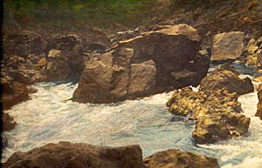
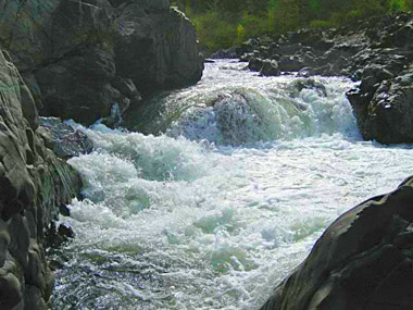
Rainie Falls
Elevation: 591 feet
Latitude: 42.64954 N
Longitude: 123.61515 W
USGS: Mt
Reuben 7 1/2"
Height & Width: Unknown
Falls Type:
Unknown
Stream: Rogue River
Watershed:
Rogue River
Best Flows: Unknown
Information
RAINIE FALLS is the
Official name of this waterfall. We are currently looking
for more info. If you have some, let us know! "Add More
Info" at bottom of page.
Location
Along the Lower Rogue River.
From I-5, go west towards Merlin-Galice area, see map.
![]()

Upper Black Bar Falls
Elevation: 498
feet
Latitude: 42.65198 N
Longitude: 123.72891 W
Lower Black Bar Falls
Elevation: 495
feet
Latitude: 42.65334 N
Longitude: 123.73063 W
USGS:
Bunker Crk 7 1/2"
Height & Width: Unknown
Falls Type:
Unknown
Stream: Rogue River
Watershed: Rogue River
Best Flows: Unknown
Information
Upper Black Barr Falls is
the UnOfficial name of this waterfall.
Lower Black Barr Falls is
the Official name of this waterfall. We are currently looking
for more info. If you have some, let us know! "Add More
Info" at bottom of page.
Location.
Along the Lower Rogue River.
From I-5, go west towards Merlin-Galice area, see map.
![]()
Kelsey Falls
Elevation: 429 feet
Latitude:
42.69542 N
Longitude: 123.76859 W
USGS: Kelsey Peak 7
1/2"
Height & Width: Unknown
Falls
Type: Unknown
Stream: Rogue River
Watershed:
Rogue River
Best Flows: Unknown
Information
KELSEY FALLS is the
Historical name of this waterfall. We are currently looking
for more info. If you have some, let us know! "Add More
Info" at bottom of page.
Location.
Along the Lower Rogue River.
From I-5, go west towards Merlin-Galice area, see map.
![]()
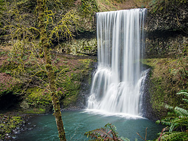
Silver Falls
Elevation: 1929 feet
Latitude:
42.47528 N
Longitude: 123.77972 W
USGS: York Butte 7
1/2"
Height & Width: Unknown
Falls Type:
Unknown
Stream: Silver Creek
Watershed:
Rogue River
Best Flows: Unknown
Information
SILVER FALLS is the
Official name of this waterfall. We are currently looking
for more info. If you have some, let us know! "Add More
Info" at bottom of page.
Location
Located on Silver Creek. in
The Rogue River National Forest. We are looking for directions, see map.
Photo By
Wojtek Powiertowski
![]()
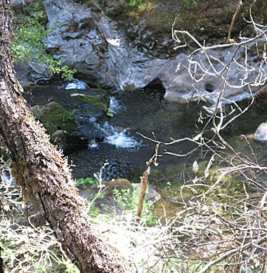
Little Todd Creek Falls
Elevation: 1357
feet
Latitude: 42.45812 N
Longitude: 123.82462 W
USGS: Unknown
Height & Width: Unknown
Falls Type:
Unknown
Stream: Little Todd Creek
Watershed: Rogue River
Best Flows: Unknown
Information
Little Todd Creek Falls is
the Unofficial name of this waterfall. We are currently looking
for more info. If you have some, let us know! "Add More
Info" at bottom of page.
Location
Remotely located on Little
Todd Creek near Silver Creek in The Rogue River National
Forest Area. We are looking for directions, see map.
![]()
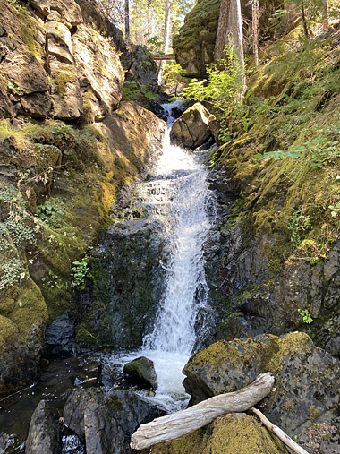
Briggs Creek Falls
Elevation: 2198 feet
Latitude:
42.45722 N
Longitude: 123.69056 W
USGS Chrome Ridge 7
1/2"
Height & Width: Unknown
Falls Type: Unknown
Stream: Briggs Creek
Watershed: Rogue River
Best
Flows: Unknown
Information
BRIGGS CREEK FALLS is the
Unofficial name of this waterfall. We are currently looking
for more info. If you have some, let us know! "Add More
Info" at bottom of page.
Location
Located on Briggs Creek in the
Rogue River National Forest Area. We are looking for directions, see map.
Photo By
Gary Swanson
![]()
Taylor Creek Falls
Elevation: 3294 feet
Latitude: 42.46789 N
Longitude: 123.60661 W
USGS Onion
Mtn 7 1/2"
Height & Width: Unknown
Falls
Type: Unknown
Stream: Taylor Creek
Watershed:
Rogue River
Best Flows: Unknown
Information
Taylor Creek Falls is
the Official name of this waterfall. We are currently looking
for more info. If you have some, let us know! "Add More
Info" at bottom of page.
Location
We believe it is remotely
located towards the end of Taylor Creek, just west of the
end of W. Pickett Creek in the Rogue River National Forest
Area. We are looking for directions, see map.
Photo
By
Gary Swanson
![]()
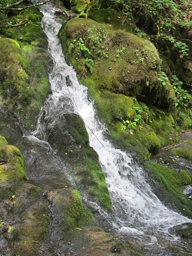
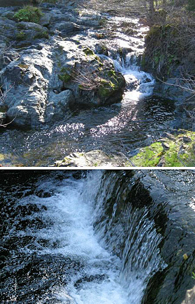
Limpy Creek Falls
Elevation: 1486 feet
Latitude:
42.42997 N
Longitude: 123.55147 W
USGS Quadrangle: ?
Height: 12' Width: 3'
Falls Type: Unknown
Stream: Limpy Creek
Watershed:
Rogue River
Best Flows: Spring
Facilities:![]()
Information
Limpy Creel Falls is the
Unofficial name of this waterfall. The
trail to Limpy Creek Falls is called the Limpy Creek
Botanical Trail. It belongs to the U.S. Forest Service and
they have 5 or 6 botanical kiosks with information on what
you might see. The Limpy Creek Botanical Trail is fairly
level and less than a mile long, and they do allow dogs.
The waterfall is about 1/2 mile in. The trail is well
maintained. The Vine Maples are in full color now. The peak
season for wildflowers is April. Couples have been married
here as well.
Location
Located
on Limpy Creek in the Rogue River National Forest Area,
From Hwy. 199 you make a right on Riverbanks Road and a
left on Limpy Creek Road to the parking area. See map.
![]()
Swede Basin Falls
Elevation: 2978 feet
Latitude: 42.37972 N
Longitude:
123.69688 W
Stream: Swede Creek
Watershed: Rogue River
Location
Swede Basin Falls is located on Swede Creek in the Rogue River
National Forest Area.
The falls is over the rim where
the creek drops off from the hanging valley (Swede Basin)
over pretty steep cobbly terrain. The hike isn’t far (less
than a quarter mile) from the road, but it’s indeed
difficult hiking terrain. Loose cobble. The easiest
approach would be to hike from the north side of the creek.
NEARBY:
Onion
Creek Falls (nearby)
Elevation: 2813 feet
Latitude: 42.39233 N
Longitude: 123.65232 W
Stream: Onion Creek
Watershed: Rogue River
Green Onion Falls
Elevation: 2814 feet
Latitude: 42.39449 N
Longitude: 123.64268 W
Stream: Onion Creek
Watershed: Rogue River
Best Flows: Unknown
-----------
Onion Creek is located nearby on Onion
Creek.
Green Onion Falls appears to be located nearby on
a branch of Onion Creek.
All Three Of These Waterfalls are the
Unofficial names. Searching for More
Information
![]()
Illinois River Falls
Elevation: 1002 feet
Latitude: 42.30306 N
Longitude: 123.77417 W
USGS: Pearsoll Peak 7 1/2"
Height & Width: Unknown
Falls Type: Unknown
Stream: Illinois River
Watershed: Illinois
River
Best Flows: Unknown
Information
ILLINOIS RIVER FALLS is the
Official name of this waterfall.
LITTLE ILLINOIS
RIVER FALLS is the Official name of this waterfall.
The Little Illinois River Falls
Elevation is: 1194 feet.
Latitude: 42.23923 N -- Longitude:
123.67983 W
USGS Quadrangle: Cave Junction 7 1/2"
Stream: Illinois River
Location
Located on the Illinois River near Eight Dollar Mountain
near Wilderville/Selma/Hwy 199 area.
Photo By
Gary Swanson
![]()
BACK TO WATERFALLS
Add More Information!
We Can Add More Information to
this page, Click Here and supply
your text info and we will add it in!
Note: SouthernOrenon.com does not provide any
other specific directions or information by phone about
these Waterfalls or Parks, other than what is shown on the
pages.
This Waterfall page is used for general
informative purposes only. Visitors should verify these
locations, facilities and amenities before driving to these
remote region. This information on is
provided to users on an "as is" and "as available" basis without
warranty of any kind either express or implied. We are not responsible for any diving misdirections or info, if any, on this page. See terms page if needed.