DRIVING DIRECTIONS:
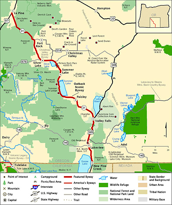
![]() Starting
in La Pine, taken SR 31 down past Silver Lake,
Summer Lake and Paisley until route turns into
US 395.
Starting
in La Pine, taken SR 31 down past Silver Lake,
Summer Lake and Paisley until route turns into
US 395.
![]() Drive
remaining portion of route on US 395 until byway
ends just past Lakeview at the Oregon/California
border.
Drive
remaining portion of route on US 395 until byway
ends just past Lakeview at the Oregon/California
border.
Note:
Highlighted byway routes shown on maps of
All-American Roads and National Scenic Byways
correspond to designations made by the U.S.
Secretary of Transportation. State designations
may differ.
Map & Information Courtesy of
National Scenic Byways Online.